Where
The marine parks surrounding Lord Howe Island (LHI), the Lord Howe Marine Park (Commonwealth waters) and the Lord Howe Island Marine Park (NSW waters).
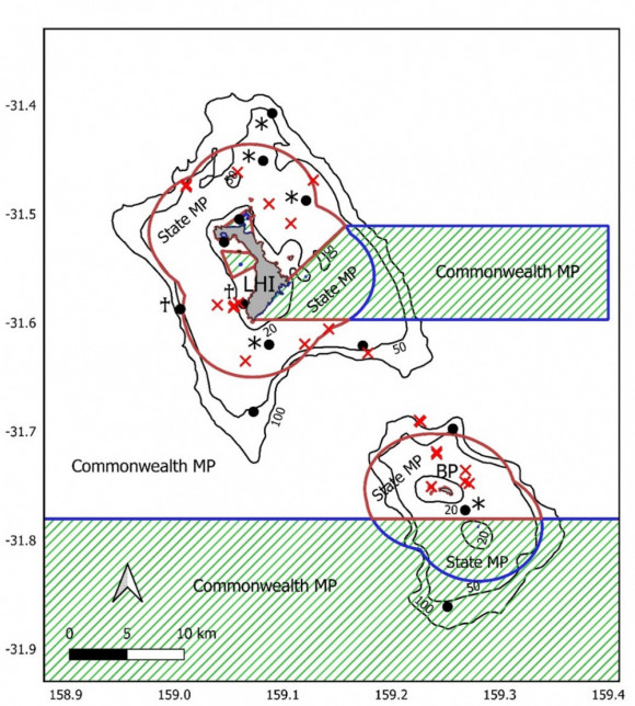
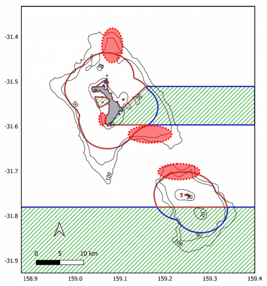
Detailed map showing acoustic receiver locations (black circles) and shark tagging locations (red crosses). Solid dark red lines show the boundaries of the Lord Howe MP (Commonwealth waters) and the Lord Howe Island Marine Park (NSW waters). No-take zones are marked with hashed green lines. Solid black lines indicate the 20, 50 and 100m depth contours. Key: LHI = Lord Howe Island, BP = Ball’s Pyramid
* denotes receivers which were only deployed between January 2018 and January 2019
♰ indicates receivers which were deployed from January 2019 to January 2021.Who
A collaborative team of researchers and managers:
- Dr. Jonathan Mitchell, The University of Western Australia and Queensland Government, Department of Agriculture and Fisheries
- Dr. Victoria Camilieri-Asch, The University of Western Australia and Queensland University of Technology
- Mr. Justin Gilligan, New South Wales Department of Primary Industries
- Ms. Sallyann Gudge, New South Wales Department of Primary Industries
- Ms. Caitlin Woods, New South Wales Department of Primary Industries
- Dr. Vic Peddemors, New South Wales Department of Primary Industries
- Dr. Fabrice Jaine, Integrated Marine Observing System, Animal Tracking Facility
- Dr. Tim Langlois, The University of Western Australia
When
July 2017 – September 2021. Tagging of sharks and initial deployment of listening stations around Lord Howe Island occurred in January 2018, with servicing and data collection occurring every 12 months.
Why
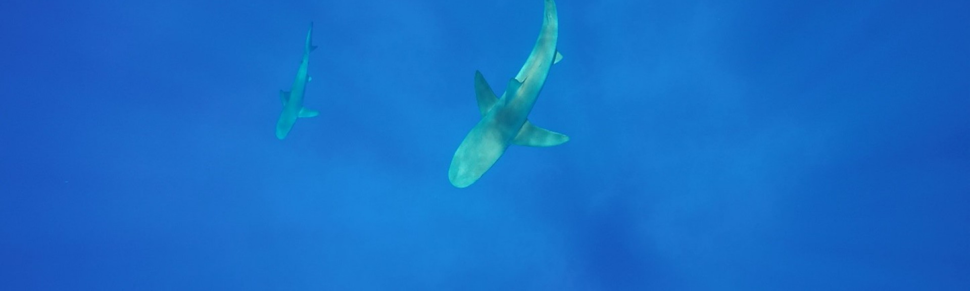
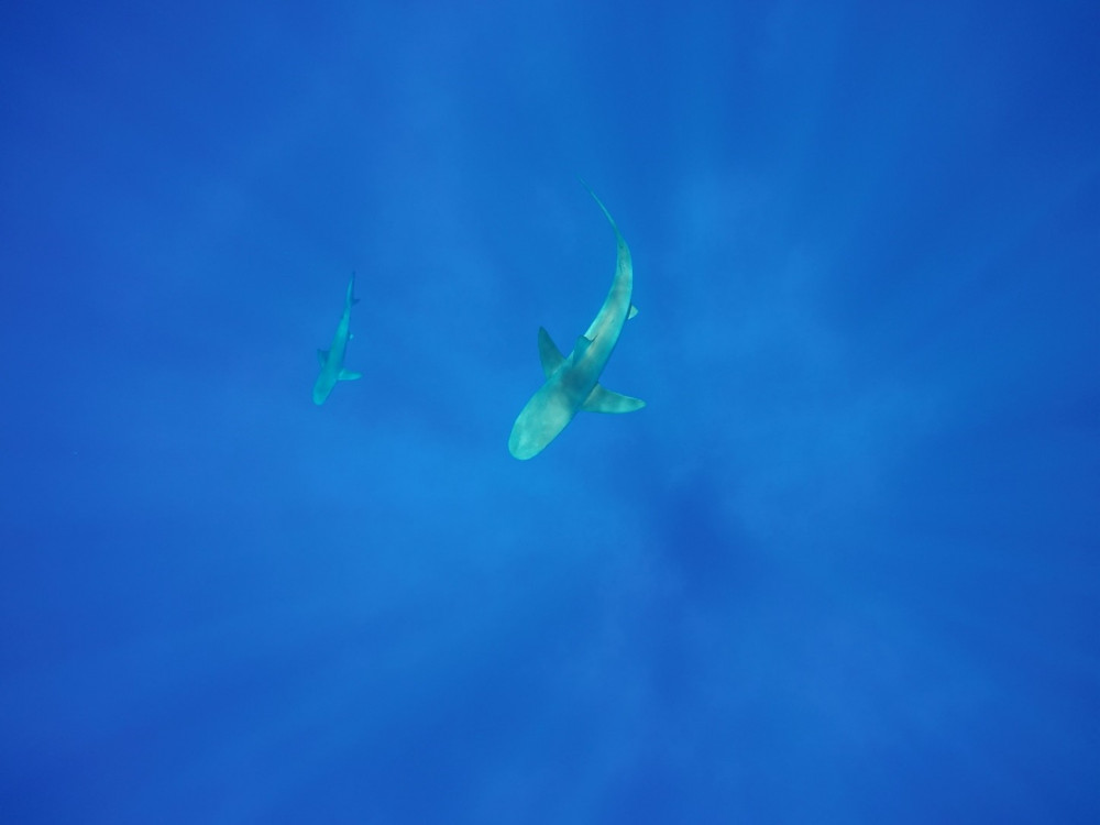
To inform management responses to the issue of Galapagos shark or 'whaler sharks' depredation in marine parks surrounding Lord Howe Island.
Shark depredation is where a shark eats a fish hooked by fishers before it can be retrieved, causing negative impacts on marine park values. Lord Howe Island fishers have reported this issue for many years, threatening the productivity and sustainability of both the local fishery and the local community. Very little is known about the movement ecology of Galapagos sharks in these marine parks or the wider south-west Pacific region. Therefore, learning more about the movement patterns of these sharks, and where and how they overlap with fishing activity, is an essential first step to managing depredation. Identifying key ‘hotspots’ where shark presence and fishing activity overlap and then communicating this information to local fishers, can help them make more informed choices about where to fish to reduce shark depredation rates.
How
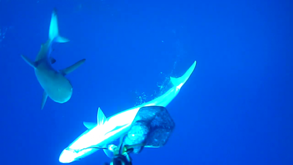
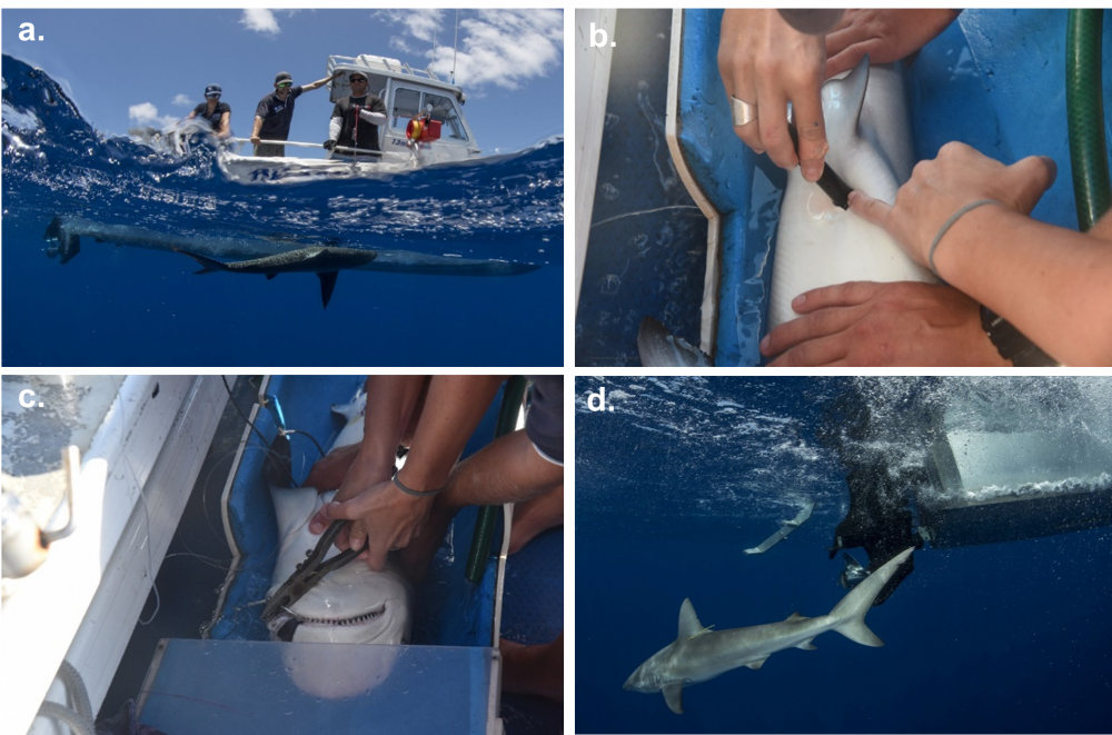
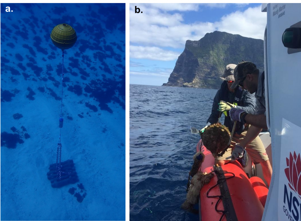
To identify the movement patterns, residency and home range of the Galapagos sharks around Lord Howe Island, 30 individuals were tagged with acoustic tags in January 2018. A series of listening stations which can detect these tagged sharks over a radius of 500-1000 m were deployed around the marine parks for 3 years, to identify which areas the sharks spend more time in. To investigate how the shark movements relate to fishing vessel activity, satellite-based Vessel Monitoring System (VMS) data was used for the charter fishing vessels that operate in these waters. This allowed us to generate maps of where key ‘hotspots’ of shark movements and fishing activity were overlapping, which can enable fishers to make more informed choices about where to fish to reduce the likelihood of encountering sharks. We also conducted a survey of charter and recreational fishers on Lord Howe Island to learn about how shark depredation impacts them and whether they currently use any measures to mitigate it.
What did we learn
Galapagos sharks were detected in every month of the three-year study period, with five individuals showing high and consistent numbers of detections all year round, indicating that at least part of the Galapagos shark population within the marine parks is resident.
A range of statistical techniques were used to investigate the movements, home range and residency patterns of tagged sharks, how they overlapped with fishing vessel activity and how they were influenced by environmental factors.
Home range areas of tagged sharks were highly variable, ranging from 0.28 km² – 217.65 km² (mean = 75 km2). Three sharks with the smallest home range areas spent most of their time at the site where fish waste was regularly disposed. Some of the sharks’ home range areas also closely overlapped with areas of greatest fishing activity, particularly at the edges of the north-east and south-east LHI shelf and the northern Balls Pyramid shelf.
Four key ‘hotspot’ areas were identified where fishing activity and Galapagos shark habitat use overlapped the most. A map of these ‘hotspots’ has been shared with fishers to help them make more informed decisions about where to fish, to potentially reduce shark interactions.
The combination of shark movement data, fishing vessel activity data and information collected from fisher surveys, has facilitated the development of best-practice guidelines to help fishers reduce negative shark interactions in the marine parks. Key recommendations for fishers include avoiding hotspots where shark movements and fishing activity were found to overlap, moving location regularly when fishing, avoiding fishing in the same area on consecutive days, fishing in deeper water (>150 m), using electric reels and handlines instead of rod and reel, jigs and lures instead of bait, diversifying target species and bringing back fish waste for disposal on land.
Overall, this collaborative research project has used a multi-disciplinary approach and worked closely with the LHI fishing community to provide detailed insights into the behaviour and movement ecology of Galapagos sharks and their interactions with fishing activity. This research represents a critical first step towards informing approaches to reduce shark depredation in the marine parks surrounding LHI.
What next
To build on this research, our team will disseminate the results of the research and recommendations for minimising shark depredation to the Lord Howe Island community and broader fishing and research communities. On top of this, we plan to test the effectiveness of two new electrical shark deterrents never scientifically tested before in this context, to determine whether they can provide a practical solution to mitigate shark bycatch and depredation. To further understand the fisher-shark conflict occurring, we aim to continue the deployment of acoustic listening stations in the Lord Howe Marine Park and satellite tag 10 adult Galapagos sharks, to identify whether larger individuals move greater distances than the juveniles studied in this project.
A mini documentary about the research was produced by Andre Rerekura and Anoushka Freedman for Parks Australia and NSW DPI.
Related data and publications
The final report on this research was delivered to Parks Australia in September 2021.
Two peer-reviewed scientific publications are being produced on this research, as follows:
Mitchell, J.D., Camilieri-Asch, V., Jaine, F., Peddemors, V., Langlois, T. (in prep) Applying acoustic telemetry, vessel tracking and fisher knowledge to investigate and manage shark-fisher conflict at Lord Howe Island.
Mitchell, J.D., Camilieri-Asch, V., Jaine, F., Peddemors, V., Langlois, T. (in prep) Movement ecology of Galapagos sharks in the marine parks surrounding Lord Howe Island.
The research has been presented at three scientific conferences, as follows:
Oceania Chondrichthyan Society conference (online), November 2020. Galapagos shark movements, residency and interactions with fishing vessels in the Lord Howe Island Marine Park.
World Fisheries Congress (online), September 2021. Galapagos shark movement ecology and interactions with fishing vessels in the Lord Howe Island Marine Parks.
Ocean Tracking Network conference (online), November 2021. Applying acoustic telemetry and VMS to investigate shark depredation.