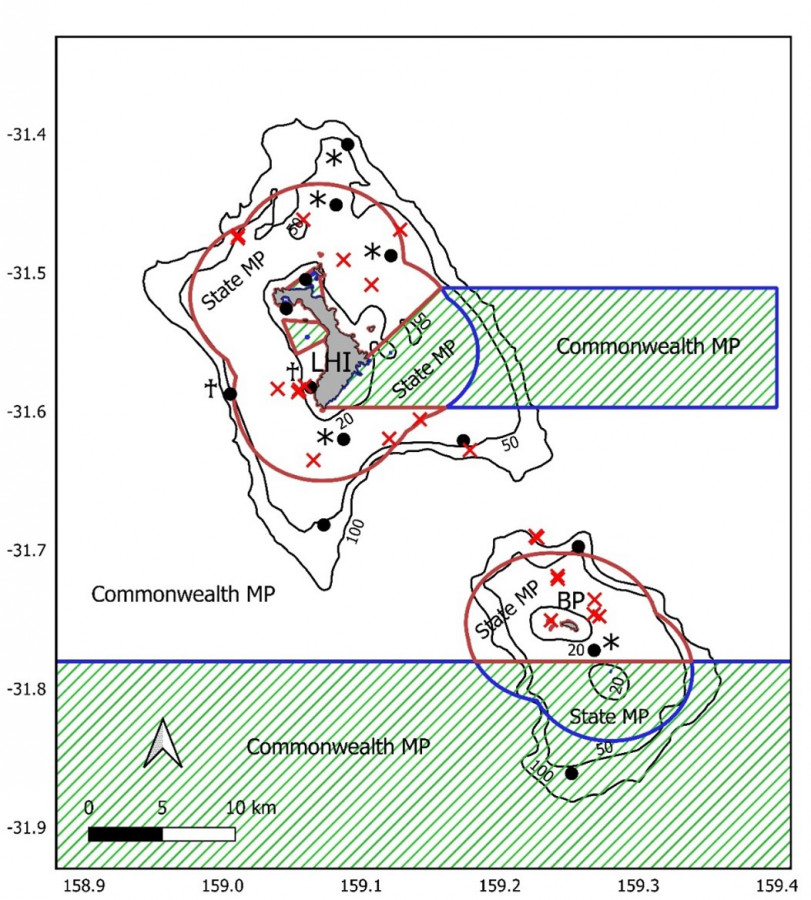
Map of Lord Howe MP

Description
Detailed map showing acoustic receiver locations (black circles) and shark tagging locations (red crosses). Solid dark red lines show the boundaries of the Lord Howe MP (Commonwealth waters) and the Lord Howe Island Marine Park (NSW waters). No-take zones are marked with hashed green lines. Solid black lines indicate the 20, 50 and 100m depth contours. Key: LHI = Lord Howe Island, BP = Ball’s Pyramid
* denotes receivers which were only deployed between January 2018 and January 2019
♰ indicates receivers which were deployed from January 2019 to January 2021.