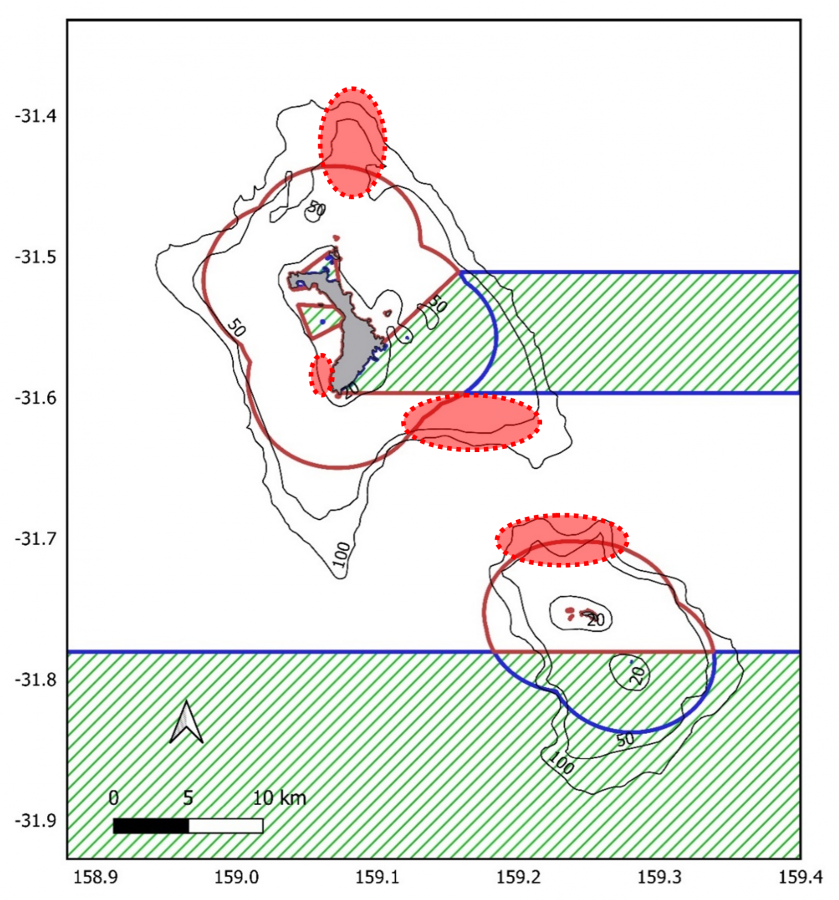
Hot Spot Areas LH Shark Presence

© courtesy University of Western Australia
Description
Hotspot areas of overlap between shark presence and fishing activity, as identified by the combination of acoustic telemetry data from tagged Galapagos sharks and Vessel Monitoring System (VMS) data from charter fishing vessels. Ovals with light red dotted lines indicate hotspots areas which should be avoided by fishers, if possible, to reduce the likelihood of encountering sharks. Solid dark red lines show the boundaries of the NSW State Marine Park and blue lines indicate the Commonwealth Marine Park. No-take zones are marked with hashed green lines. Solid black lines with numbers show the 20m, 50m and 100m depth contours.
