Where
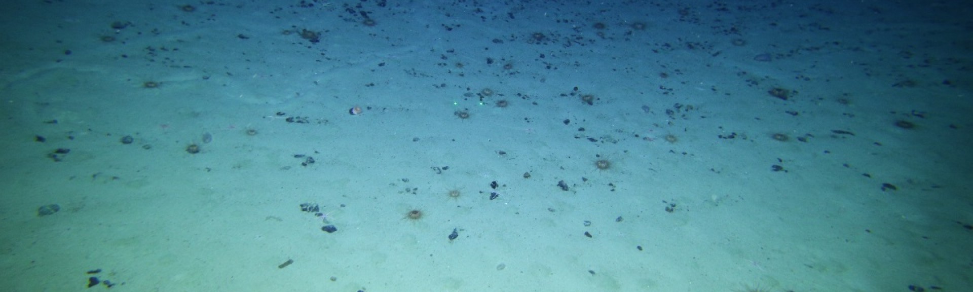
The abyss - the deepest part of the ocean, beginning at the base of the continental slope and continuing into waters deeper than 4000 metres.
When
15 May–16 June 2016
Who
Dr Tim O’Hara and 40 scientists and technicians from CSIRO, Museums Victoria and other Australian and international museums and research agencies.
Why
The abyss is the largest habitat on earth, covering almost half of the global ocean and one third of Australia’smarine estate, however until recently it has remained virtually unexplored. Despite its depth, this deep-sea habitat is still affected by human activities because abyssal ecosystems rely heavily on detrital food that rains down from above and settles on the seafloor. Surveying the abyss will improve our understanding of the biodiversity that exists in the deep ocean, as well as the ecological processes that sustain it, and provide us with a baseline to help detect changes to this ecosystem caused by human activities.
How
A month-long expedition in 2017 visited seven Marine Parks on the east coast of Australia (Freycinet, Flinders, East Gippsland, Hunter, Central Eastern and Coral Sea), collecting data along the way. A range of different techniques were used to look at different aspects of the abyssal ecosystem, including multibeam sonar, plankton nets, bottom sleds, sediment corers and cameras. This enabled scientists to build the first picture of the seafloor terrain and the types of habitats and biotic communities that exist deep below the sea surface.
What did we learn?
Acoustic mapping using a multibeam echosounder revealed a diverse seascape of canyons, plains and underwater mountains. Marine fauna were sampled using plankton and fishing nets, bottom sleds, sediment corers and cameras, and many kinds of weird and wonderful species were collected, including many that are new to science. The mysterious creatures the team uncovered include tripod fish, dragon fish, carnivorous sponges, tube-dwelling worms and the blind cusk eel. Each of these show interesting adaptations which allow them to survive in a deep, dark world 4000 metres below the surface where water pressure is high and there are no daily or seasonal changes, no water turbulence, precious little hard substrata and a scarce food supply.
What next?
The samples collected on the voyage are still being analysed. Scientists are looking to use carbon, nitrogen and sulphur isotopes from selected species to investigate the energy sources that sustain life on the abyssal plain, and DNA samples will be used to measure gene flow between populations and see how they are connected. Analysis of sediment samples will reveal the extent of microplastic pollution in the deep ocean, and the flora and fauna sampling surveys, conducted at 2500 and 4000 metres depths at intervals of 1 degree latitude, will help in building maps of biodiversity patterns along the voyage route.
Related data and publications
NESP Marine Biodiversity Hub news article - About the voyage
CSIRO news article - Sampling the abyss: a voyage into the world of jelly and fangs!
O’Hara, Tim. (2019). The Eastern Australian Marine Parks: Biodiversity, assemblage structure, diversity and origin. Report to Parks Australia from the National Environmental Science Program Marine Biodiversity Hub. Museums Victoria.
For more information please contact marinescience@environment.gov.au.