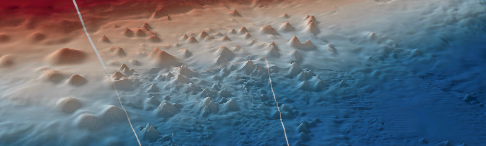
Huon Marine Park displays multiple levels of seabed habitats from the large cluster of seamounts on the continental slope to low profile reefs and sediment plains on the continental shelf. It covers representative areas of four bioregions.
Knowledge status
Huon Marine Park has a medium to high level of knowledge.
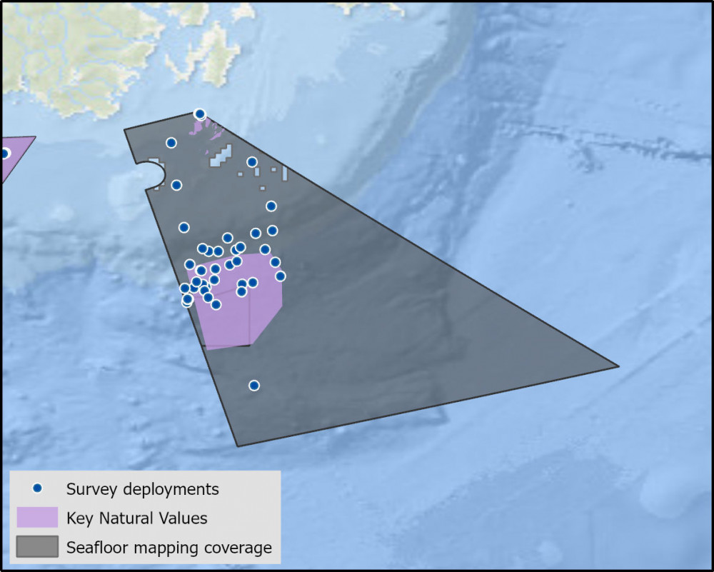
- Much of the shelf break and continental slope has been mapped, including reef and seamount ecosystems. The shelf reefs and seamount habitats have been the focus of biological surveys owing to their unique structure and high level of biodiversity and species endemism they provide.
- There have been 73 imagery deployments over 5 campaigns and 18 sediment samples collected from 2 surveys.
- There are 24 publications, reports and data sets that reference the South east network and relate to Huon Marine Park as well as 8 publications that are specific to Huon Marine Park.
- Depth: 40m – 4040m.
- 96% of seafloor mapped, almost all at medium to high resolution to support habitat mapping and biodiversity surveys.
Key values, habitats and communities
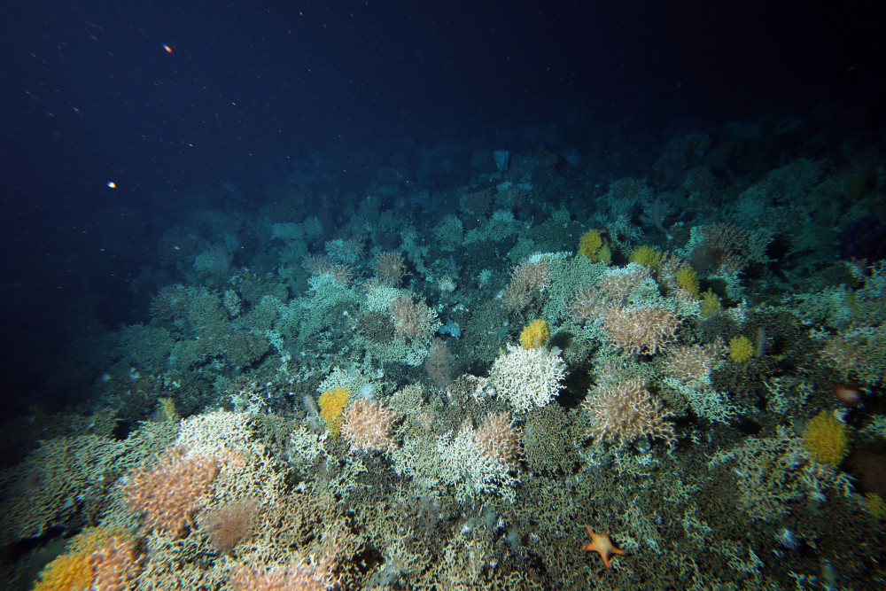
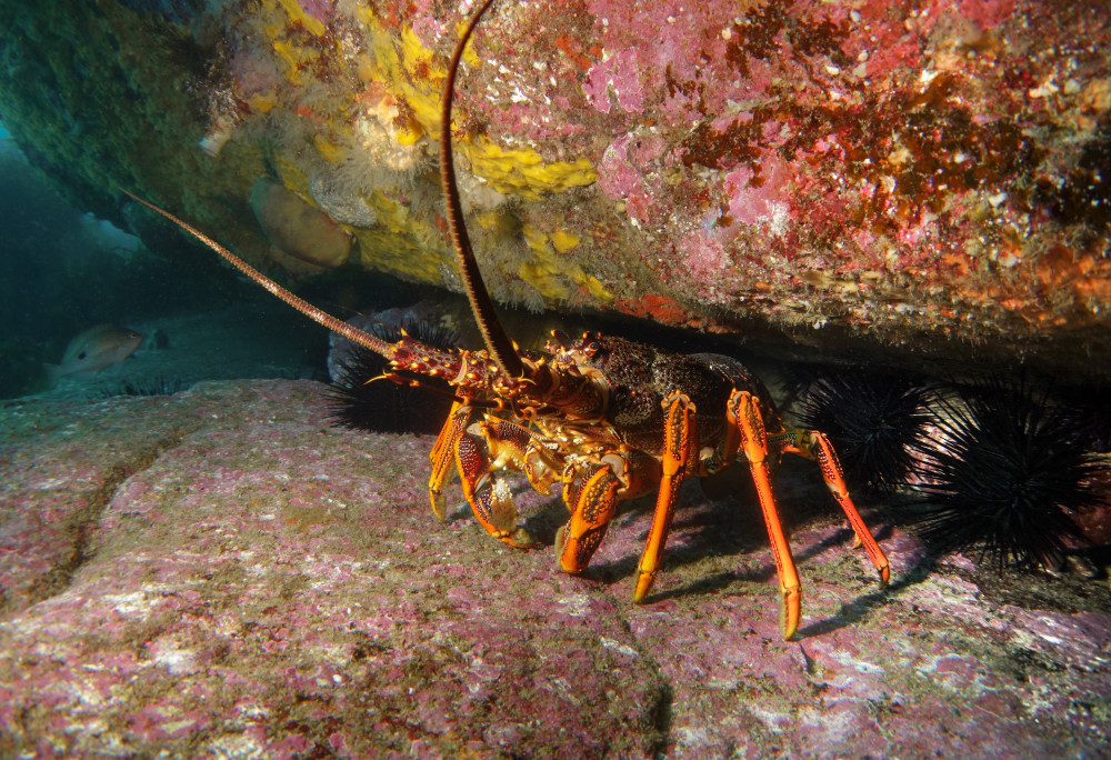
The Huon seamounts are inhabited by diverse deep-sea coral communities including stony reef building corals and habitat forming octocorals2. These rocky reef ecosystems are inhabited by predators such as Southern Rock Lobsters, which are important for ecosystem functioning3.
Feature of interest
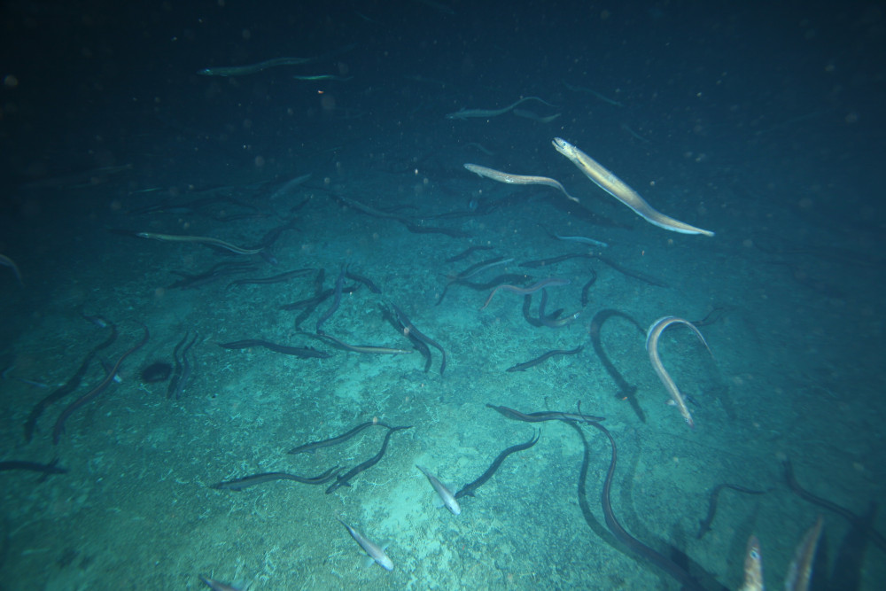
Patience Seamount supports a spawning aggregation of basketwork eels (Diastobranchus capensis) - the only reported spawning aggregation of oceanic eels globally1. The park contains one of the world’s largest cluster of seamounts (underwater mountains)4.
Monitoring priorities
Is the condition of deep-sea coral communities on seamount reefs improving after the removal of historic pressures?
Key gaps
- Seafloor mapping of NW and NE sections of the park
- Distribution of deep-sea coral communities on Seamounts and slope areas.
- Basketwork eel aggregation extent, timing and duration
Key activities
- Commercial fishing
Key Pressures
- Resource extraction
- Climate change
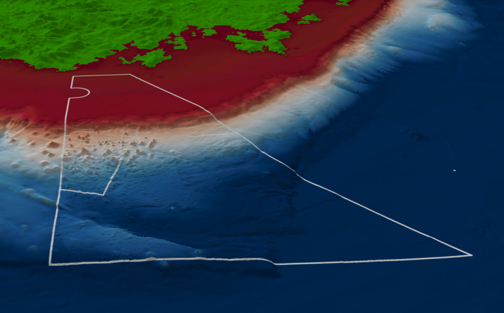
Seafloor mapping coverage and survey deployments
Further information
State of Knowledge published Mar 2023 | References:
- Lucieer et al (2019). An eco-narrative of Huon Marine Park: South-east marine region. Report to the National Environmental Science Programme, Marine Biodiversity Hub. 25 pp.
- Monk et al (2017). Biological and habitat feature descriptions for the continental shelves of Australia’s temperate-water marine parks- including collation of existing mapping in all AMPs. Report to the National Environmental Science Programme, Marine Biodiversity Hub. Institute of Marine and Antarctic Studies, University of Tasmania.
- Perkins et al (2021) Analysis of a time-series of benthic imagery from the South-east Marine Parks Network. Institute of Marine and Antarctic Studies. University of Tasmania, Hobart, Tasmania.
- Williams et al. (2020) The Fate of Deep-Sea Coral Reefs on Seamounts in a Fishery-Seascape: What Are the Impacts, What Remains, and What Is Protected? Front. Mar. Sci. 7:567002.
Key Natural Values (KNV) = Habitat or species that are particularly important to management.
Printable version: AMP - SE SOK Placemat templates (parksaustralia.gov.au)