Franklin Marine Park is dominated by shelf unvegetated sediment habitat with high-profile deep reef features in the northern section. It covers representative areas of four bioregions. The northern section of the park contains complex reef likely formed by volcanic lava flows, which at its shallowest depths of 35m support kelp forests (Ecklonia radiata) - a rare habitat type in Australian Marine Parks.
Knowledge status
Franklin Marine Park has a medium level of knowledge.
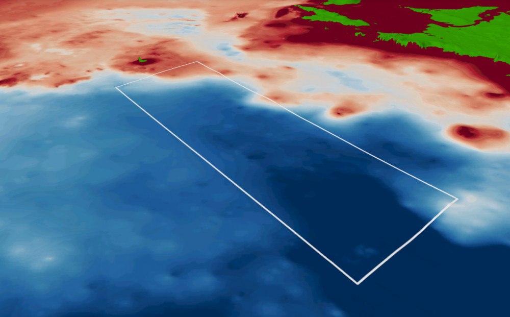
- The reef habitats have been a focus of fine-scale mapping efforts in the park. The northern and southern ends of the park have been continuously mapped. Limited biological surveys have been undertaken.
- There have been limited surveys of Franklin Marine Park, with a dedicated biological survey in 2022 sampling and imagery is yet to be analysed.
- There are 6 Publications, reports and data sets that reference the South east network and relate to Franklin Marine Park as well as 1 publication specific to Franklin Marine Park.
- Depth: 49m – 116m.
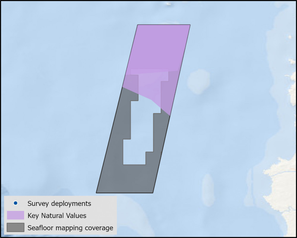
- 55% of seafloor mapped, almost all at medium to high resolution to support habitat mapping and biodiversity surveys
Key values, habitats and communities
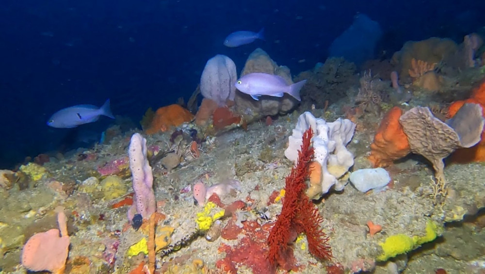
The southern end of the park contains limestone pavement outcrops, and is sponge dominated in areas of higher relief.
Feature of interest
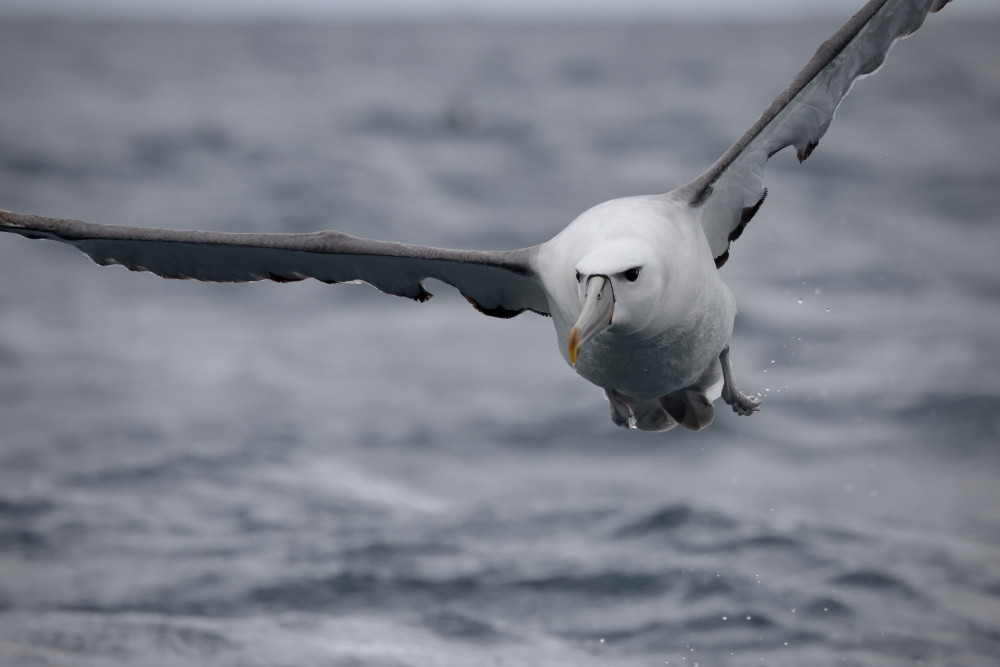
The northern half of the Franklin Marine Park is a core foraging area for the endangered Shy Albatross (Thalassarche cauta) which breeds exclusively on three offshore Tasmanian islands – one of which is Albatross Island to the north-east of the park.
Key gaps
- Fine scale mapping, and validation of features of the north and north-east section of the park
- Characterise the deep (mesophotic and rariphotic) shelf reefs benthic communities and demersal fish communities.
Key activities
- Commercial fishing
- Shipping
Key Pressures
- Resource extraction
- Climate change
- Underwater noise
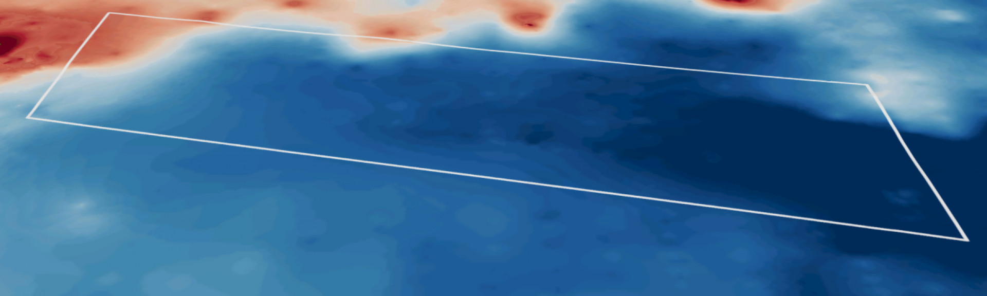
Seafloor mapping and survey deployments
Further information
State of Knowledge published Mar 2023 | References:
- Davey et al. 2022. Hydrographic Survey of Zeehan and Franklin Marine Parks, West Coast Tasmania.
- Pers. comm. Neville Barrett, 2022.
- Mason et al. 2018. Telemetry reveals existing marine protected areas are worse than random for protecting the foraging habitat of threatened shy albatross (Thalassarche cauta)
Key Natural Values (KNV) = Habitat or species that are particularly important to management.
Printable version: AMP - SE SOK Placemat templates (parksaustralia.gov.au)