
Where
Inside and to the west of the Bremer Marine Park.
Who
Professor Charitha Pattiaratchi (University of Western Australia). Funding by NESP Marine Biodiversity Hub (Emerging Priorities Program), Parks Australia, Integrated Marine Observing System (IMOS)
When
March to April 2017
Why
Australia’s South-west marine region is dominated by the warm, low-nutrient and low-salinity waters of the poleward-flowing Leeuwin current, which inhibit large-scale upwelling common to other eastern ocean basins. Despite this inhibition, hotspots of high marine productivity occur locally as a result of complex interactions between surface and subsurface currents, strong winds and submarine topography. The underwater canyons of the Bremer Marine Park are one such hotspot, where seasonal pulses of productivity attract significant numbers of megafauna during the austral summer months.
The physical conditions required to support these wildlife aggregations, however, remain poorly documented. This project allowed the collection of physical data necessary for refining our understanding of the oceanic processes likely to underpin ocean food webs in the Bremer ecosystem. Such insights are important for managing the timing and location of human activities within and outside the park.
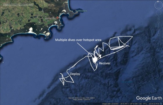
Google Earth image of the glider track in white from deployment to recovery. Glider tracks can look like "Mr Squiggle" drawings. This is because the gliders are propelled only by a buoyancy engine and their movement can be overpowered by strong ocean currents. In the latter part of the mission, the glider returned to the hotspot area where it did multiple dives before it was recovered.
How
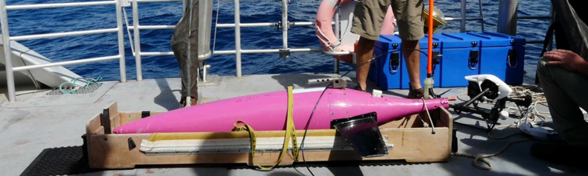
An autonomous underwater vehicle (Seaglider) was deployed on March 11, 2017 west of the Knob Canyon and navigated eastward along the continental slope for a 6-week period. The glider made more than 150 ‘dives’ to depths of up to 1000 metres, taking continuous measurements of water temperature, salinity, dissolved oxygen and other biogeochemical parameters along repeat,sawtooth transects crossing the Henry, Hood and Bremer canyons. This survey was the only the second of its kind for the area and built upon the results of a previous mission conducted by the Integrated Marine Observing System in 2013. Data processing and quality control were carried out at the University of Western Australia.
What did we learn?
Substantial variation in both temperature and salinity was apparent within the top 100–200 metres of the water column, indicating the presence and interaction of different water masses overlying the canyons of the Bremer region, in addition to the well-known Leeuwin Current. Water parameters stabilised below this layer, and reflected values characteristic of the deeper westward-flowing Flinders Current. The highest concentrations of chlorophyll occurred at depth, though periodic mixing allows productivity to reach surface layers. Minimal hydrocarbon traces were detected during the sampling period.
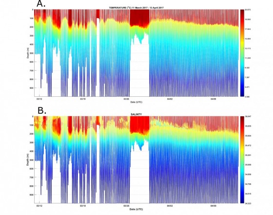
This figure shows (a) seawater temperature and (b) seawater salinity from the surface to 1000 metres depth during the Bremer Bay canyon glider mission. Patterns of seawater temperature and salinity (and therefore density) can reveal a lot about the structure of the ocean currents in a region. This figure shows relatively warm, eastward flowing Leeuwin current water down to about 200 metres depth, which overlays colder water of the Flinders Current and Antarctic Intermediate Water.
What next?
Repeat surveys at different times of the year are critically needed to enhance our understanding of variability in the duration, strength and timing of ocean processes across seasons and years.
Related data and publications
Meeuwig J, Turner J. (2017) Bremer Canyon Progress Report - NESP Emerging Priorities Project EP2 (Spatial distribution of marine wildlife in the Bremer Bay region). Report prepared for the NESP Marine Biodiversity Hub, 18 p.
Meeuwig J, Turner J, Bouchet P. (2016) Bremer Canyon Science Workshop Report - NESP Emerging Priorities Project EP2. Report prepared for the NESP Marine Biodiversity Hub, 27 p. DOI: 10.13140/RG.2.2.25891.35364.
Surveying marine life in the canyons off Bremer Bay project webpage
For more information please contact marinescience@environment.gov.au.