AMPS Atlas
This is a compilation of all the images in this Atlas. To access images from particular marine parks, navigate to the image gallery on each marine park page.
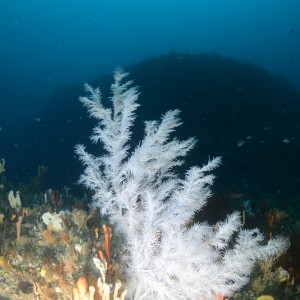
A black tree coral on Joe's Reef, Freycinet Marine Park, dwarfs the diverse sponge and invertebrate community beneath it. Black corals are named after the black colour of their skeleton, and their living tissue can take on a variety of bright colours, including white.
 by James Parkinson
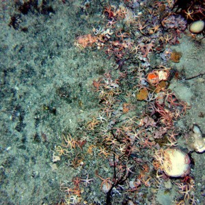
The boundary between sand habitat (on the right) and low profile reef habitat (on the left) in 90 metres depth in the Freycinet Marine Park. The boundary is marked by a distinct change in slope and a change from bare sand to a sandy/invertebrate turf cover. It is also often demarcated by dense clusters of brittle stars, potentially due to enhanced food availability due to enhanced current speeds or accumulation of detritus at the reef base. Generally these “relict coastline” reefs are very low profile as shown here, and have quite low invertebrate cover with few larger sponges.
by Institute of Marine and Antarctic Studies
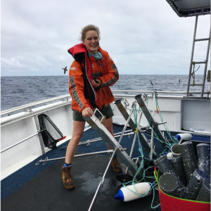
RV Challenger at the CSIRO wharf in Hobart ready for June 2012 Flinders Marine Park survey, with Baited under water video (shallow), Deep-water CSIRO Baited underwater video (topped with brightly coloured floats), plus the CSIRO Towed Video system. This NERP Hub cruise deployed baited underwater video and towed video over previously mapped seabed within the Flinders Marine Park to quantitatively determine the distribution of species and habitats within the shelf and upper slope of the Marine Park based on a GRTS-based statistical framework for spatially balanced sampling and inference.
by Institute of Marine and Antarctic Studies, CSIRO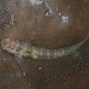
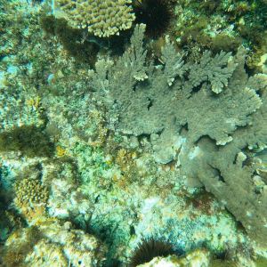
A small blenny (Ecsenius yaeyamaensis) on a massive coral. There are over 300 known species of blennies globally, most of which are restricted to tropical regions with only a few found in cool-temperate waters. Blennies are small bottowm-dwelling fish, and this particular species is commonly observed in shallow coastal reefs where it perches on boulders and live coral heads in areas of abundant coral growth.
by Reef Life Survey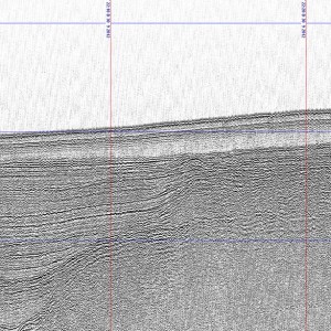
A screenshot of a sub-bottom profile collected int the Oceanic Shoals Marine Park. It shows a layered sediment (mud and sand) that has partly buried by a carbonate bank (bottom right corner). The length of the image is approximately 7.5 km, and the depth of the ocean floor is 100 m.
by Geoscience Australia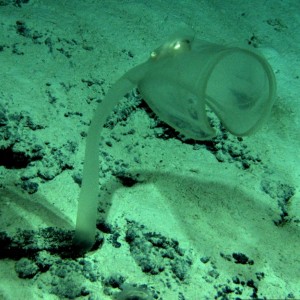
In 2009 JASON Remotely Operated Vehicle (ROV) (belonging to the Woods Hole Oceanographic Institution) undertook a voyage in the Tasman Fracture Zone off south-east Tasmania. This is a still image taken at 4006 metres showing deep water stalked carnivorous ascidian (Family Octacnemidae) approximately 50 centimetres in height. The ascidian works similar to a venus fly-trap, using the funnel-like appendage to collapse around prey that move past.
by CSIRO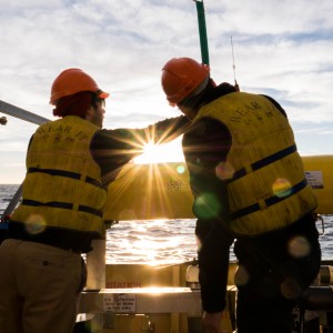
Adjusting an autonomous underwater vehicle at sunrise
by Asher Flatt
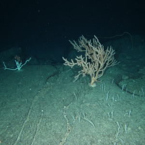
A large bamboo coral from the Huon Marine Park (1146 m depth). In this region these corals can grow to at least 2 metres tall and live for at least 370 years.
by CSIRO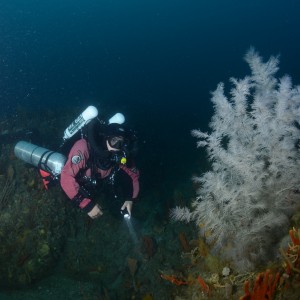
Technical diver Andreas Klocker next to a black coral on Joe's Reef, Freycinet Marine Park.
by James Parkinson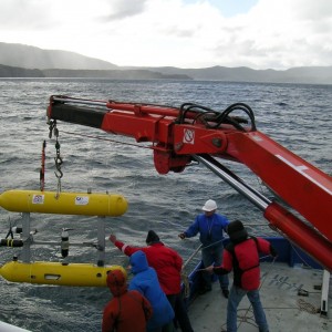
Launching an Integrated Marine Observing System autonomous underwater vehicle in Flinders Marine Park.
by Institute of Marine and Antarctic Studies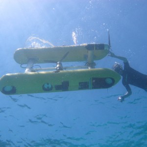
A still image of the benthos taken from an AUV in the Flinders Marine Park.
by Institute of Marine and Antarctic Studies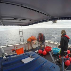
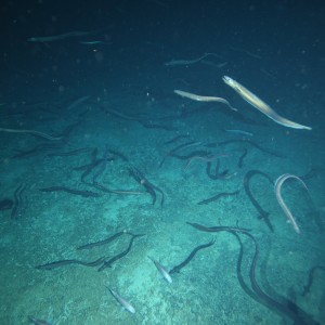
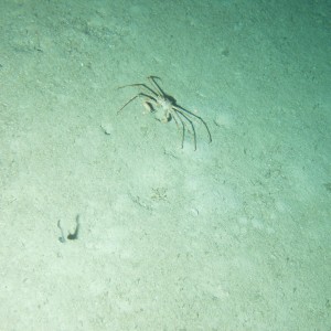
Patience seamount is the only seamount off temperate Australia where the abundant basketwork eel spawns (1092 metres depth). The eels co-exist there with schools of orange roughy.
by CSIRO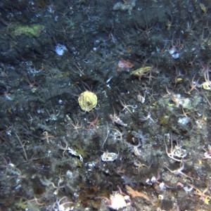
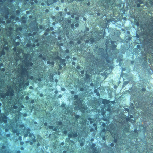
This benthic community including brittle stars, was captured by on an AUV survey.
by IMOS, AUV Sirius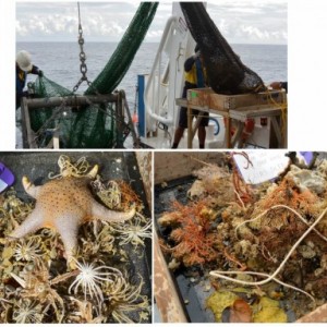
A huge black coral at Joes reef, Tasmania, surrounded by a school of perch.
by James Parkinson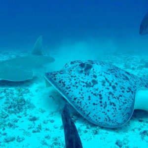

Aerial view of a boat speeding near the Abrolhos Marine Park off the off the coast of Western Australia.
by Parks Australia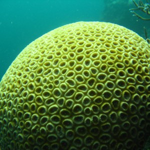
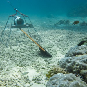
Still image of hard coral taken during underwater visual census surveys in the Houtman Abrolhos islands of Western Australia in 2008 as part of the Reef Life Survey program. The Reef Life Survey program is a volunteer network of highly trained divers, and is a product of the CERF Major Projects funding that facilitated a cost-effective citizen science contribution to inventory and monitoring of shallow water marine environments. The RLS program has been further facilitated within the NERP Hub, describing biodiversity patterns at a national and global scale, as well as providing critical baseline data from areas such as the Coral Sea Marine Park, from Ashmore Reef, the Great Barrier Reef,and other Australian Marine Park such as the Cod Grounds.
by Reef Life Survey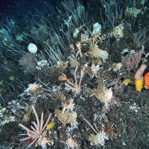
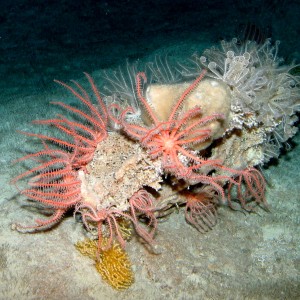
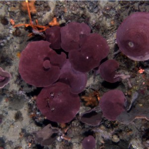
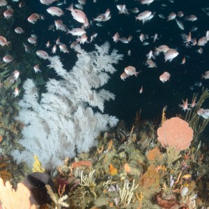
Seamounts provide hard, elevated and current-swept habitats that create a hotspot of species diversity and abundance. Here sea stars, feather stars, soft corals, glass sponges and sea urchins live among a thicket of stony corals and sea whips (1106 metres depth).
by CSIRO