AMPS Atlas
This is a compilation of all the images in this Atlas. To access images from particular marine parks, navigate to the image gallery on each marine park page.
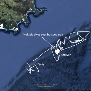
Google Earth image of the glider track in white from deployment to recovery. Glider tracks can look like "Mr Squiggle" drawings. This is because the gliders are propelled only by a buoyancy engine and their movement can be overpowered by strong ocean currents. In the latter part of the mission, the glider returned to the hotspot area where it did multiple dives before it was recovered.
 by Paul Thomson
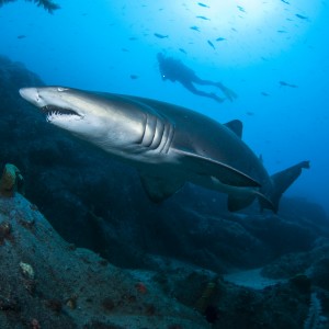
The Cod Grounds Marine Park helps to protect habitat and prey species of the grey nurse shark, pictures here with a diver off South-west Rocks.
 by Parks Australia
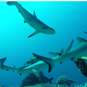
An aggregation of grey reef sharks (Carcharhinus amblyrhynchos) at Ashmore Reef, attracted by the prospect of a tasty meal attached to the baited underwater stereo system (BRUVS). This BRUVS was deployed by researchers at the Australian Institute of Marine Science and Global Finprint program in an effort to monitor the impact of the crack-down on illegal fishing on the parks shark population.
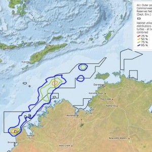
This map shows the home ranges of the 11 tracked flatback turtles during the inter-nesting period in waters off the Kimberley coast in northwest Australia. The coloured contours represent the 25, 50, 75 and 95 % habitat utilisation distributions of the turtles, and the Australian Marine Park boundaries are shown in black. For more information on about this image see Thums et al. 2017.
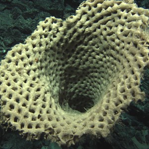
In 2009, the JASON Remotely Operated Vehicle (ROV) belonging to the Woods Hole Oceanographic Institution undertook a voyage in the Tasman Fracture Zone off south-east Tasmania. This huge "waffle-cone" glass sponge (species unknown) was photographed at approximately 2197 metres.
 by CSIRO
In September 2016 Hub researchers undertook a survey of the benthic fauna of the Freycinet Marine Park with an Autonomous Underwater Vehicle (AUV). While there, they encountered a significant number of Humpback whales that were passing through on their southward migration to Antarctic feeding grounds for summer.
 by Institute of Marine and Antarctic Studies, NESP Marine Biodiversity Hub
CSIRO workers lowering the towed video camera off the back of the vessel in preparation for a survey in the Huon Marine Park.
 by CSIRO
A still image from video showing a Mako shark approaching BRUV deployed at the shelf edge near a canyon-head incision (depth of 140 metres). This is an example of the range of species attracted to BRUV's, and the potential of the canyon-head incision areas to be productivity hotspots, targeted by top predators like mako sharks, seals and killer whales.
 by Institute of Marine and Antarctic Studies
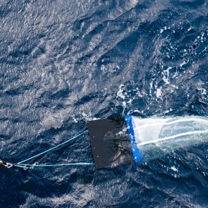
A manta net used for collecting plankton samples from the water. The net is so named because it looks like a manta-ray from above!
 by Marine National Facility
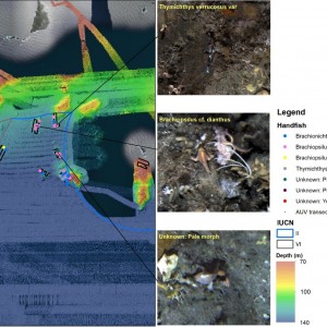
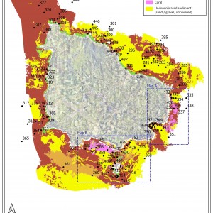
Map of handfish observed in AUV imagery across the Tasman Fracture Marine Park, along with potential species groupings.
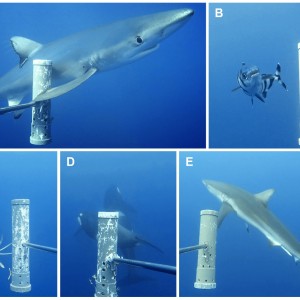
Example species detected on mid-water video systems within the Bremer Marine Park and surrounds, including the:
- (A) blue shark, Prionace glauca;
- (B) pilot fish, Naucrates ductor;
- (C) cock-eyed squid, Histioteuthis miranda;
- (D) killer whale, Orcinus orca, and
- (E) bronze whaler shark, Carcharhinus brachyurus.
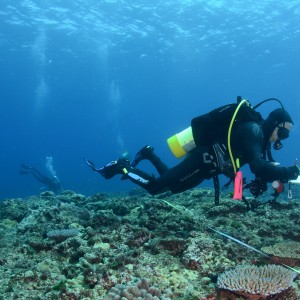
Reef Life Survey diver at Middleton Reef, Lord Howe Marine Park.
 by Reef Life Survey
School of Moorish idols (Zanclus cornutus) as recorded on Reef Life Survey volunteer transect, Lord Howe Island Marine Park, New South Wales. The Reef Life Survey program is a volunteer network of highly trained divers, and is a product of the CERF Major Projects funding that facilitated a cost-effective citizen science contribution to inventory and monitoring of shallow water marine environments. The RLS program has been further facilitated within the NERP Hub, describing biodiversity patterns at a national and global scale, as well as providing critical baseline data from areas such as the new Coral Sea Marine Park, from Ashmore Reef, the Great Barrier Reef,and other Australian Marine Parks such as the Cod Grounds.
 by Reef Life Survey
The Mumburarr Whipray is a new species of whipray collected during NESP fieldwork.
 by CDU
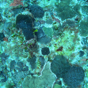
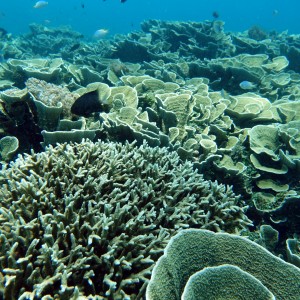
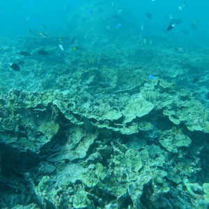
The northern sites at Ashmore had some of the highest coral cover in 2016 and were dominated by tabulate, branching and foliose corals.
 by AIMS
Communities at the northern sites at Ashmore Reef were worst affected by bleaching in 2016/17. Recently dead foliose corals were observed at this northern site in 2017.
 by AIMS
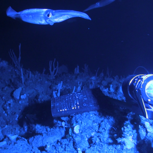
This species of Nototodarus was captured during a BRUVS survey in the Tasman Fracture Marine Park.
 by Jacquomo Monk, IMAS
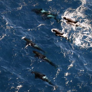
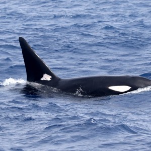
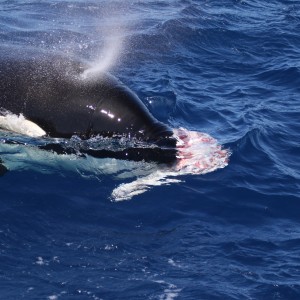
A pod of killer whales (Orcinus orca) surfaces beneath the plane during an aerial survey of the Bremer canyon.
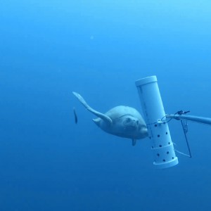
This Olive Rideley (Lepidochelys olivacea) turtle was photographed during a BRUVS survey in the Oceanic Shoals Marine Park in September 2012. Olive Ridely turtles are one of the most abundant species of sea turtles globally, however they are considered Vulnerable by the IUCN Red List of Threatened Species, and listed as Endangered under the Australian EPBC Act. Their listing is due to significant declines in global populations. In Australia few surveys on this species have been conducted, and we still have a lot to learn about where these turtles, their population size, distribution and behaviour.
 by UWA - Centre for Marine Futures
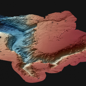
A map showing the 3D bathymetry of the Perth Canyon. The bathymetry data was collected during surveys in March 2015 at a 20 metre resolution.
 by Geoscience Australia
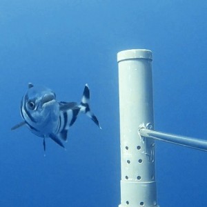
A pilot fish, Naucrates ductor, attracted to a pelagic BRUVS in the Bremer marine region.
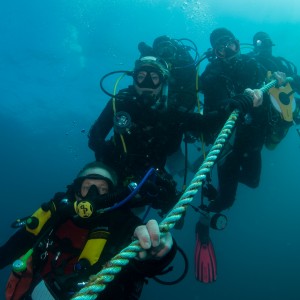
Researchers diving at Pimpernel Rock, Solitary Islands Marine Park. Photo by Rick Stuart-Smith, Reef Life Survey.
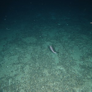
An orange roughy swims across a region where bottom trawling has removed the benthos, leaving behind a flat 2D surface of coral rubble (1061 metres depth). Species composition differs and faunal density is higher in areas where 3D habitats are formed by structural corals.
 by CSIRO
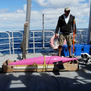
Dr. Paul Thompson from the University of Western Australia and the Integrated Marine Observing System prepares the Sea Glider for its mission. Mission preparation involves simulated glider dives on the deck prior to deployment to ensure all systems and sensors are operational.
 by Paul Thomson
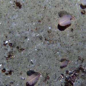
This is an AUV still image showing habitat of the Freycinet Marine Park at ~89 metres, including sandy substrate, sea pens and sponges. Sea pens are colonial marine organisms and each individual pen is made up of many animals. These animals are called polyps and they look like miniature anemones with eight tentacles which they use to catch plankton and other small organisms from the water column to feed. Sea pens typically occur in deeper waters where there is less turbulence, and unlike most soft corals they occur in soft sandy environments, anchoring themselves in the sediment with a bulbous base.
 by Institute of Marine and Antarctic Studies
