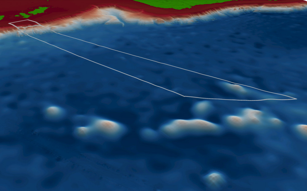
Flinders Marine Park contains soft sediment and hard substrate shelf areas, canyons, deep (mesophotic) reefs, and seamounts2. It covers representative areas of four bioregions.
Targeted biological surveys have revealed diverse benthic communities of hydrozoans, bryozoans, ascidians and sponges. Monitoring of these communities has been undertaken using Automated Underwater Vehicles (AUVs)3.

Knowledge status
Flinders Marine Park has a medium level of knowledge.
- Fine-scale mapping exists for the shelf break, all of the upper and mid continental slope and much of the lower slope. Targeted biological surveys and monitoring has focused on deep reefs.
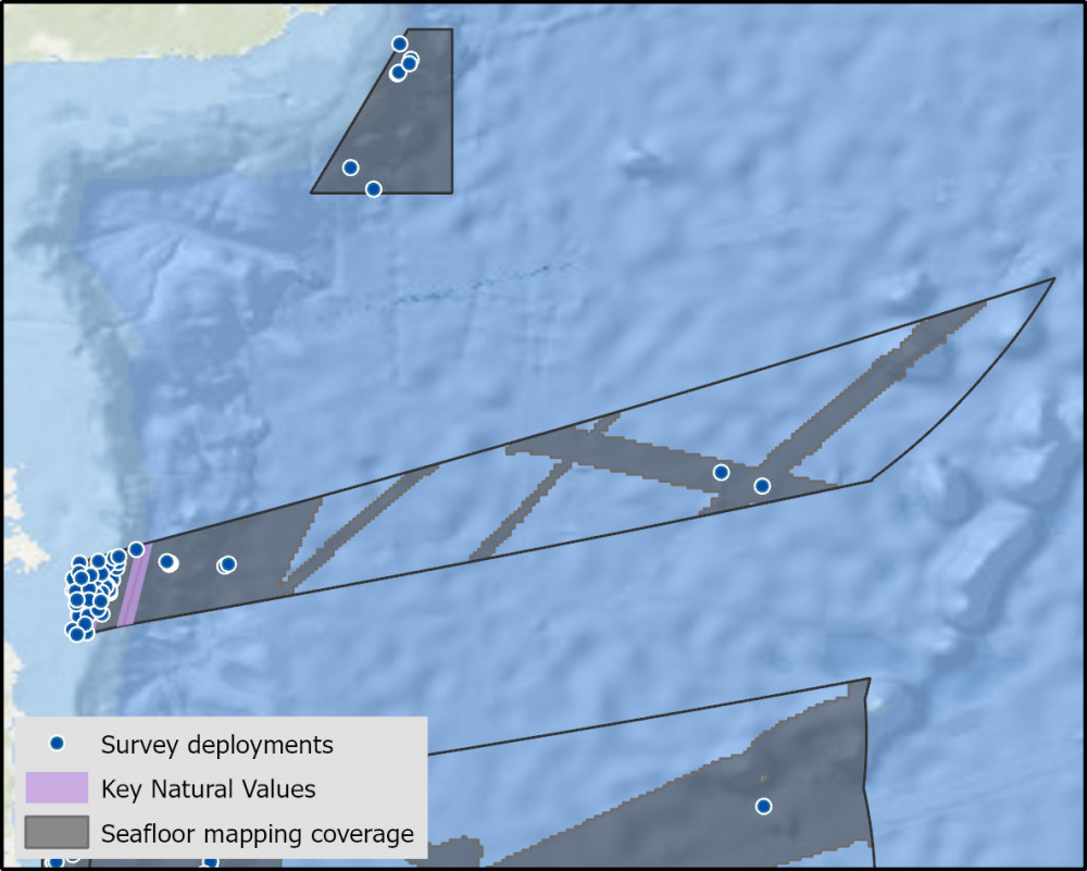
- There have been 22 imagery deployments over 3 campaigns, 64 video deployments over 2 campaigns, and 154 sediment samples collected from 6 surveys.
- There are 15 Publications, reports and data sets that reference the South east network and relate to Flinders Marine Park, as well as 2 publications specific to Flinders Marine Park.
- Depth: 34m – 5041m.
- 33% of seafloor mapped, with much at medium to high resolution to support habitat mapping and biodiversity surveys.
Key values, habitats and communities
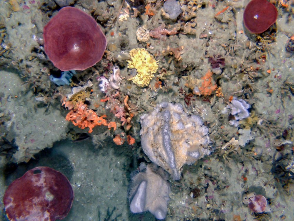
Long linear reef features that extend over kilometres are often undercut forming small caves and ledges. A diverse sessile invertebrate community of hydrozoans, bryozoans, ascidians and sponges occur on these features1.
The central western boundary of the park has mesophotic reefs habitat with red cup sponges, a dominant feature of this site. Unique fish communities associated with rare outcroppings of shelf break reefs are a feature of the park. Rock lobsters are also present within the park.
Two major canyons occur within the park featuring large benthic fauna such as bamboo octocorals on the rocky outcrops, where topography is steeper. The Flinders canyons and upper slope reef supports a high abundance of rare corals1.

Feature of interest
Biologically diverse survey sites with a variety of sponges, cnidarians, and hydroids, including large gorgonian fans and soft coral species unique within the South-east network.

- Additional seafloor mapping of the shelf.
- Benthic communities of canyons and upper slope reefs and sediments.
- Changes in reef and sediment communities due to climate change and other pressures.
- Recreational fishing effort and catch in the Multiple Use Zone.
Key activities
- Commercial fishing
- Recreational Fishing
- Shipping
Key Pressures
- Resource extraction
- Climate change
- Underwater noise
Seafloor mapping and survey deployments

Further information
State of Knowledge published Mar 2023 | References:
- Perkins et al. (2019). Analysis of a time-series of benthic imagery from the South-east Marine Parks Network. Institute of Marine and Antarctic Studies.
- Monk J, et al (2016a) Outcropping reef ledges drive patterns of epibenthic assemblage diversity on cross-shelf habitats..
- Althaus et al (2016) Analysis of approaches for monitoring biodiversity in Commonwealth waters: Field work report.
Key Natural Values (KNV) = Habitat or species that are particularly important to management.
Printable version: AMP - SE SOK Placemat templates (parksaustralia.gov.au)

