Beagle Marine Park contains an extensive area of soft sediment with some areas of rocky reef, which are likely to be a relict sand dune field prior to sea level rise. The park covers representative areas of three bioregions.
Knowledge status
Beagle Marine Park has a medium level of knowledge.
- Representative areas of the park and some identified priority park values have been mapped. Biological surveys have focused on the deep rocky reefs.
- There have been 12 imagery deployments over 2 campaigns, 80 video deployments over 1 campaign, and 36 sediment samples collected from 4 surveys.
- Publications, reports and data sets include 11 South east network that relate to Beagle Marine Park and 4 Beagle Marine Park specific publications.
- Depth: 46m – 77m.
- 62% of seafloor mapped, much of it at medium to high resolution to support habitat mapping and biodiversity surveys.
Key values, habitats and communities
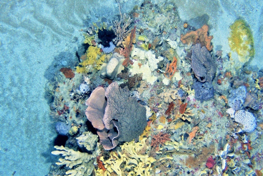
The small area (~5km2) of reef between the Kent and Hogan islands group has been a focus of research and support a sessile invertebrate assemblage comprised of bryozoans, hydroids and a high diversity of temperate sponges1.
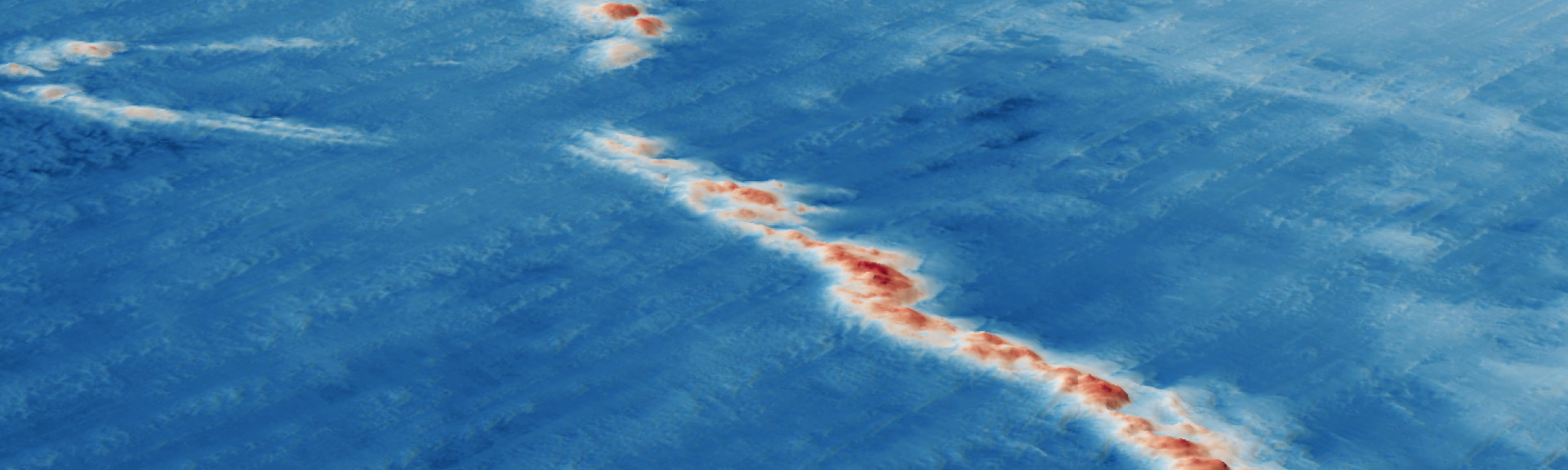
Deep (mesophotic) reef is a rare ecosystem in the bioregions within Bass Strait. This reef is exposed to large currents leading to high biological productivity and provides habitat for a diverse range of species. An incredible density and diversity of sponges provide food for other species by concentrating the nutrients swept past in the currents. The marine park was once dry land which made up part of a land bridge to Tasmania.
Feature of interest
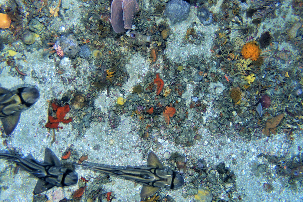
An aggregation of hundreds of Port Jackson Sharks (Heterodontus portusjacksoni) was observed along the central reef ridges between Hogan Island group and Kent Island group during July 2018. It is thought these reef features may be an important shelter location for this species during winter foraging migrations to Bass Strait. Yet to be determined if these aggregations are an annual occurrence1
Known underwater cultural heritage
Beagle Marine Park contains two shipwrecks within its Multiple Use Zone, the SS Cambridge (1940) and the SS Queensland (1876)2.
Monitoring priorities
Is the condition of demersal fish communities associated with deep (mesophotic) rocky reefs and shelf sediment ecosystems maintained through ecologically sustainable use?
To what extent is climate change affecting our ability to protect and conserve natural values?
Key gaps
- validate features inferred from seafloor mapping
- Mapping of comparable habitat outside park boundaries
- school and gummy shark numbers
- impact of invasive New Zealand screw shell (Maoricolpus roseus) on native scallop beds.
- soft sediment benthic communities
Key activities
- Commercial fishing
- Recreational fishing
- Shipping
Key pressures
- Resource extraction
- Climate change
- Underwater noise
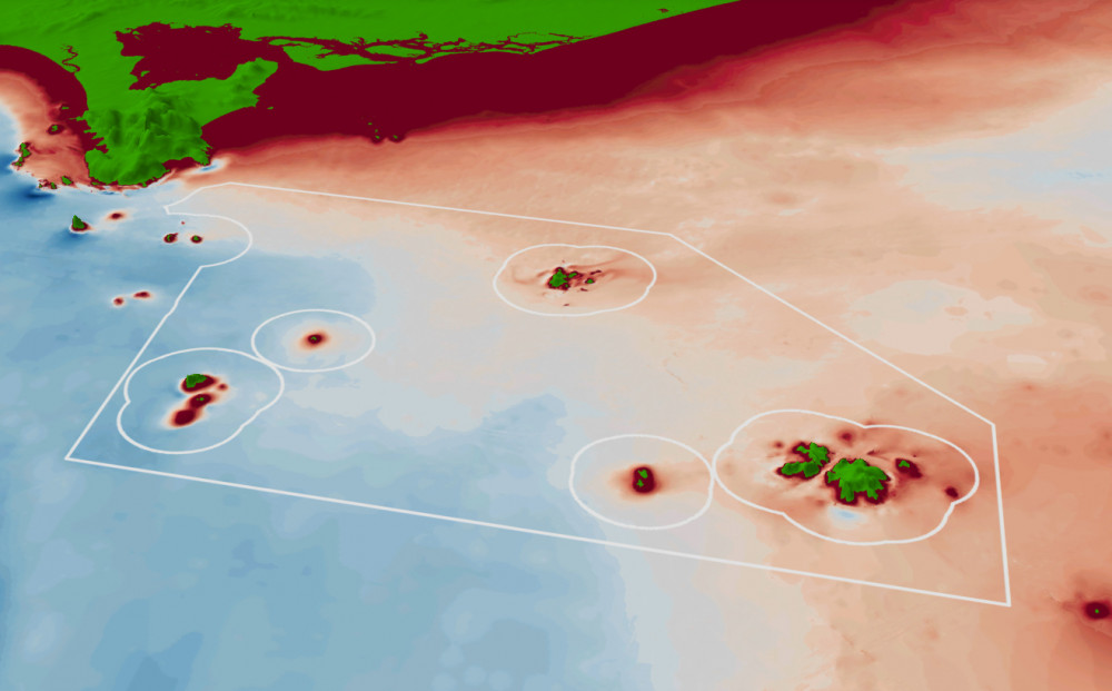
Seafloor mapping and survey deployments

Further information:
| State of Knowledge published Mar 2023 |
- Barrett et al (2020). Beagle Marine Park: Post Survey Report. Report to the National Environmental Science Program
- Protected under the Underwater Cultural Heritage Act 2018 (UCH) and included on the National and Commonwealth Heritage Lists under the Environment Protection and Biodiversity Conservation Act 1999 (EPBC Act).
Key Natural Values (KNV) = Habitat or species that are particularly important to management.
Printable version: AMP - SE SOK Placemat templates (parksaustralia.gov.au)