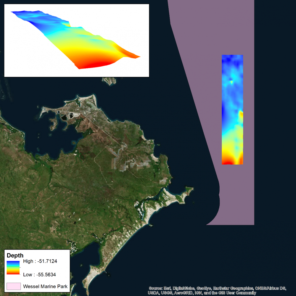
Multibeam operations in Wessel Marine Park
Where
Who
Researchers from the Australian Institute of Marine Science (AIMS).
When
February 2019
Why
Mapping the seafloor allows us to build a picture of what lies beneath our vast oceans. These maps are useful in determining the depth (bathymetry) of the seafloor, and discovering important seafloor features and habitats.
How
Acoustic multibeam surveys use sound to map the depth and topography of the seafloor. An acoustic profiler, attached to the hull of a vessel, sends out a soundwave (or ‘ping’) at regular intervals. This soundwave travels through the water, and upon hitting the seafloor it is reflected back to the boat and the acoustic profiler.
The return signal has different properties than when it was originally sent out, and these properties, with reference to existing field data, can be used to build a picture of the seafloor. The time between sending and receiving the soundwave can be used to calculate the depth (bathymetry) of the seafloor, and generate bathymetric (topographic) maps.
What did we learn?
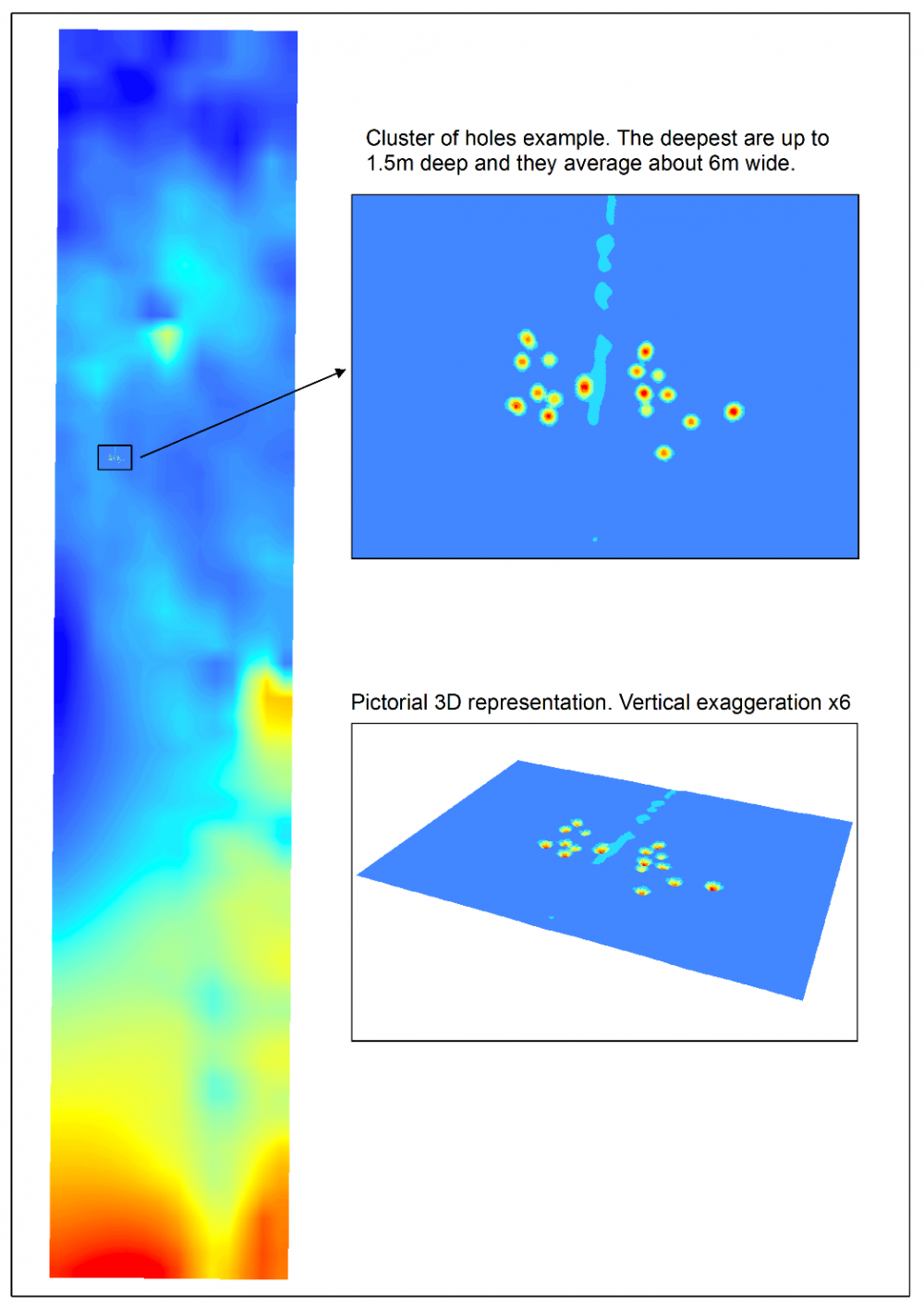
The multibeam survey area is a relatively flat homogeneous area spanning 50-55m depth, which is most likely comprised of sandy mud (Heap, et al., 2004). However groups of holes or depressions were seen scattered throughout the multibeam survey area. The deepest holes were up to 1.5m deep and they average about 5m wide.
The observed holes are likely to be pockmarks. Pockmarks are commonly seen in muddy areas in Australia’s northwest continental shelf and were first observed in Australia in the Oceanic Shoals Marine Park. They are thought to be formed through turbulence and scouring associated with bottom currents, and may represent areas of different biodiversity compared with adjacent habitats. Visual surveys (e.g. by ROV or AUV) are likely to be the best method to better understand the nature of the pockmark features in the Wessel Marine Park.
What next?
Large parts of the Wessel Marine Park are still unsurveyed. Additional mapping of this region will aid our understanding of seabed characteristics in the marine park, as well as provide insights on features likely to support important biodiversity in the park.
Publications
Case M., Harries S., Miller K., 2019. Wessel Marine Park Multibeam Survey. Report to Parks Australia. 13 pp
Picard K.,Radke L., Williams D., Nicholas W., Siwabessy J., Howard F., Gafeira J., Przeslawski R., Huang Z., Nichol S., 2018. Origin of High Density Seabed Pockmark Fields and Their Use in Inferring Bottom Currents. Geosciences 2018, 8, 195.