Where
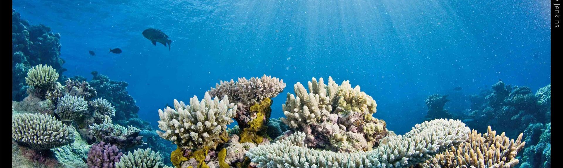
Osprey Reef, Holmes Reef and Flinders Reef in the Coral Sea Marine Park
Take a virtual swim through Osprey Reef
Who
When
September 2012
Why
Coral reefs are some of the most valuable and diverse ecosystems on the planet, however in the last 30 years the world has lost 40 percent of its corals due to pollution, destructive fishing and climate change. According to the scientific community, the decline is set to continue. This will affect 500 million people globally who rely on coral reefs for food, tourism income and coastal protection. Creating a visual record of the condition of the world's coral reefs provides a baseline from which change can be monitored over time, and will help scientists, policy makers and the public to see and understand the issues reefs are facing and work out what needs to be done to best protect coral reefs now and into the future.
How
The XL Catlin Seaview Survey team visited 32 reefs along the entire length of the Great Barrier Reef and out into the remote Coral Sea in September 2012 as part of their first coral reef survey. In total, 150 kilometres of reef was surveyed and 105,000 images collected. The surveys use a specially designed SVII underwater camera to swim transects approximately 2 kilometres in length along coral reefs across the globe. The camera takes continuous high-resolution 360-degree panoramic images, and each is accurately GPS-located, allowing sites to be revisited so that changes can be assessed over time. The imagery contributes towards the XL Catlin Global Reef Record database, and is analysed for coral coverage and species diversity using sophisticated image recognition technology that is under development in collaboration with SCRIPPS Institute of Oceanography in San Diego. Three-dimensional reconstructions of the structure of the reef are also generated using the imagery which are useful to help scientists monitor change and assess biodiversity.
What did we learn?
The images generated during this first survey are currently being analysed by marine scientists around the globe. The imagery captured throughout the survey is available on the XL Catlin Seaview Survey website.
Click on the links below to TAKE A VIRTUAL SWIM through Osprey, Holmes or Flinders Reefs.
What next?
Due to the success of these first surveys on the Great Barrier Reef and Coral Sea reefs, the XL Catlin project has gone global. Thanks to the ongoing support from the founding sponsor, the speciality insurance group XL Catlin, reefs across the globe are continually being surveyed. The aim is to carry out a rapid assessment of reefs and other oceanic environments around the world and create a scientific baseline record with which to monitor global change.
Related data and publications
For more information please contact marinescience@environment.gov.au.