Latest maps
Since the initial planning of Australian Marine Parks culminationg in the 2012 declaration of their outer boundaries, new and finer scale data has emerged that improves understanding of the features of the parks and the pressures acting upon them. The maps below plot these latest datasets.
Published on 20 July 2018
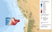
Fine scale bathymetry information is available for the Perth Canyon Marine Park
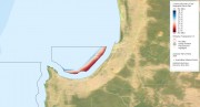
Published on 20 July 2018
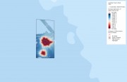
Fine scale bathymetry information is available for the Gifford Marine Park
Published on 20 July 2018
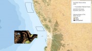
Explore the seafloor features of the Geographe Marine Park
Published on 20 July 2018
Explore the seafloor features of the Perth Canyon Marine Park
Published on 20 July 2018
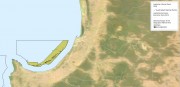
Fine scale bathymetry information is available for the Geographe Marine Park
Published on 3 May 2018

Find out where the seafloor has been mapped with sonar across the Marine Parks.
Published on 27 April 2018
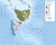
Fine scale bathymetry information is available for the Tasman Fracture Marine Park
Published on 27 April 2018
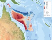
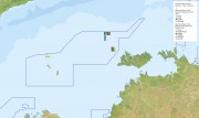
Fine scale bathymetry information is available for the Coral Sea Marine Park
Published on 26 April 2018
Explore the seafloor features of the Coral Sea Marine Park
Published on 26 April 2018
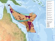
Explore the seafloor features of the Oceanic Shoals Marine Park