Where
Ningaloo Reef, Ningaloo Marine Park (Commonwealth waters)
Who
Researchers from CSIRO and University of Western Australia (UWA).
When
August 2019
Why
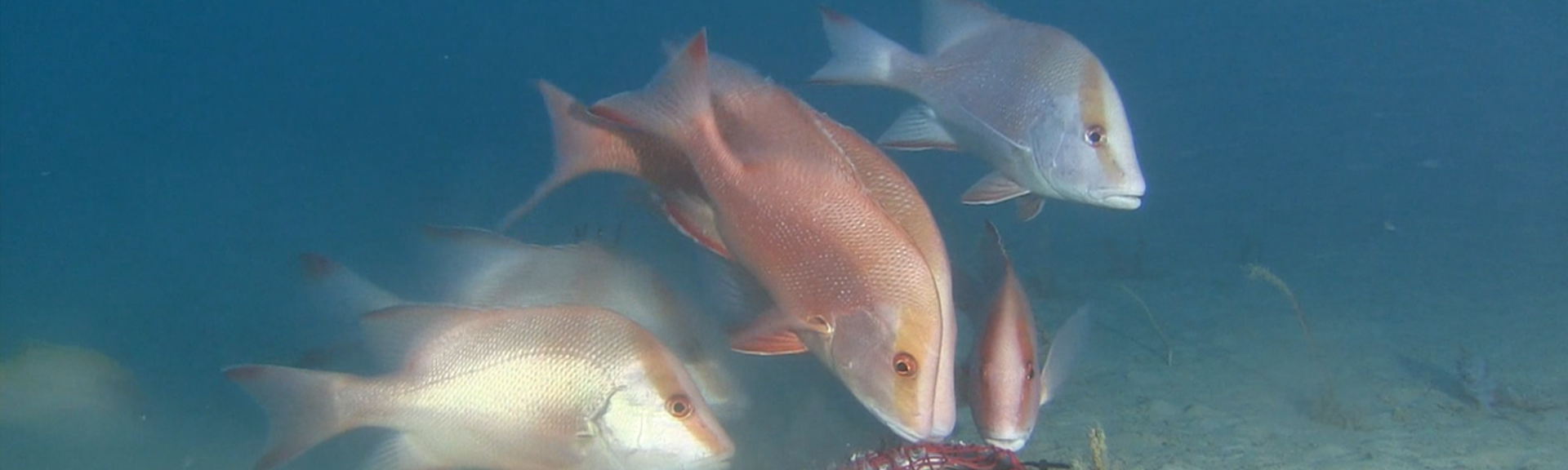
In August 2019, researchers from CSIRO and UWA spent a week in Ningaloo Marine Park (Commonwealth waters), sending cameras down to the deeper parts of Ningaloo Reef. Their footage has revealed gardens of sponges and gorgonian sea fans populated by red emperor, gold band snapper, ornate rock lobster, comet grouper and potato rockcod.
The objective of their research was to benchmark the habitats and fish populations in Ningaloo Marine Park, where little research has previously been done at these depths.
How
The team, led by Dr Tim Langlois, deployed baited remote underwater stereo-video systems (stereo-BRUVs), made up of a pair of video cameras, at 133 sites within the marine park. These sites were located inside the Point Cloates National Park Zone and along the northern part of the reef. The sites varied in depth between 55 and 190 meters. At each site, the camera system was positioned at the bottom of the sea and one hour of footage was recorded.
A range of species are attracted to the BRUV and the two cameras allows the team to record the relative abundance and length of fish. The recorded footage can also be used to examine the relationship between fish assemblages and the benthos (the community of life on the seabed) and record habitat metrics such as sponge and coral coverage.
Dr Russ Babcock's research team is also consolidating historical and more recent seafloor mapping data to produce the first continuous habitat map of the area, to help inform research and management.
BRUVs are a great way to witness life in deeper and hard-to-reach habitats which makes it a vital survey method for Australian Marine Parks. Find out more about this approach here.
What did we learn?
The data collected will allow scientists and park managers to assess how habitats and fish communities differ by depth and location across the marine park. It will also be used to assess ecosystem health and develop biodiversity baselines. Over time, these baselines will provide a benchmark against which to assess trends in fish populations.
Ningaloo Reef is a popular fishing destination and protecting this recreational value of the marine park is an important management objective. As part of the analysis, the research team will be taking a close look at understanding the relationship between the structure and composition of fish communities and the abundance of individual species, and the distance from vessel access points.
This information will help us better understand fishing pressures across the marine park.
A number of the sites visited during this voyage have been previously sampled so this data will consolidate and further expand on data collected across both the State and Commonwealth Ningaloo Marine Parks since 2006. It also builds on previous CSIRO and UWA collaborations funded by the West Australian Marine Science Institution and the Government of Western Australia through their Net Conservation Benefits program
What next?
Over time, the data will help us to understand how different pressures are influencing biodiversity across the marine park and assess the impact of marine park management activities. The data from the Point Cloates no-take zone will make a particularly useful contribution to this assessment as this area will be exposed to fewer pressures. The data will also build our understanding of the natural values of the marine park and help inform future management decisions.