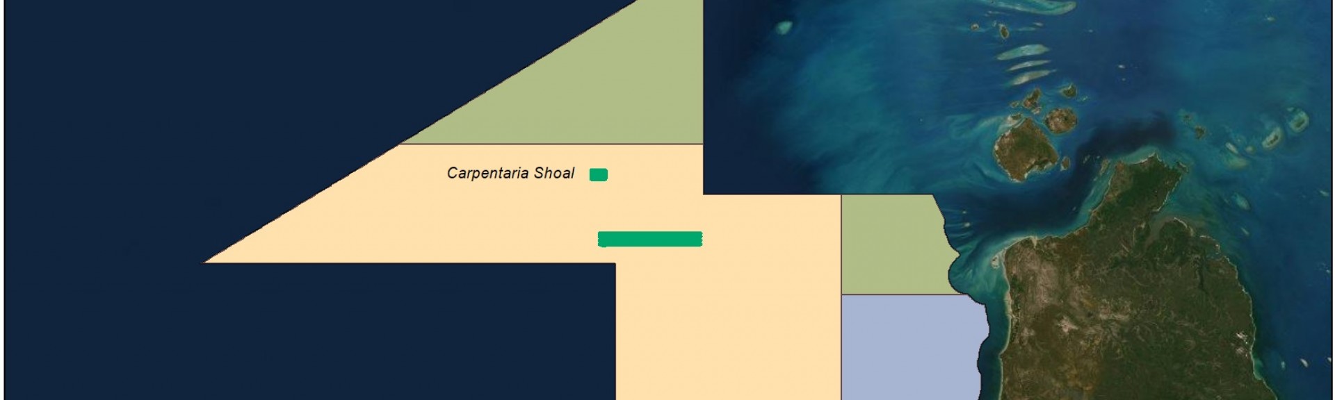
Where
The northern region of the Gulf of Carpentaria located south west of Torres Strait, Queensland.
Who
The Australian Institute of Marine Science (AIMS) was contracted by Parks Australia to undertake opportunistic multibeam bathymetry mapping.
When
18th – 19th November 2019. A total of 24 hours of multibeam survey was completed.
Why
Mapping the seafloor allows us to build a picture of what lies beneath our vast oceans. These maps are useful in determining the depth (bathymetry) of the seafloor, and discovering important seafloor features and habitats.
How
Acoustic multibeam surveys use sound to map the depth and topography of the seafloor. An echo sounder, attached to the hull of a vessel, sends out a soundwave (or ‘ping’) at regular intervals. This soundwave travels through the water, and upon hitting the seafloor it is reflected back to the boat and the echo sounder. The return signal has different properties than when it was originally sent out, and these properties, with reference to existing field data, can be used to build a picture of the seafloor. The time between sending and receiving the soundwave can be used to calculate the depth (bathymetry) of the seafloor, and generate bathymetric (topographic) maps.
What did we learn?
The multibeam survey details the morphology of Carpentaria Shoal and surrounds providing precise depths of shoal features. Carpentaria Shoal covers 2.2 km2 down to 30 metres depth and the flat plateau on top of the shoal covers 1km2 in depths between 15 and 18 metres.
Across the shallow region on top of the plateau there is a complex arrangement of low relief ridges and small bommies. The seabed around the shoal has a steep transition from the plateau rim down slope to a generally flat area between 28 to 35 metres in depth, apart from a slightly more rugose area in the south western region of the survey. Carpentaria Shoal appears to be consistent with patch reef geomorphology that is found in the southern region of the Gulf of Carpentaria (Harris et al., 2004).
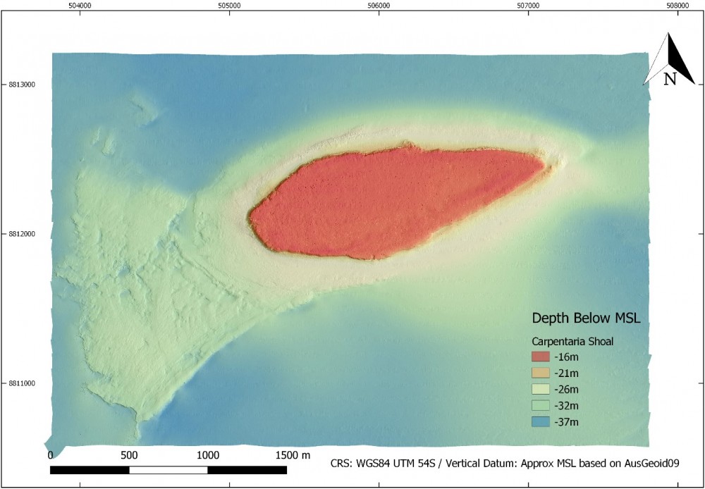
Figure 1: Multibeam bathymetry (gridded at 1m) for Carpentaria Shoal.
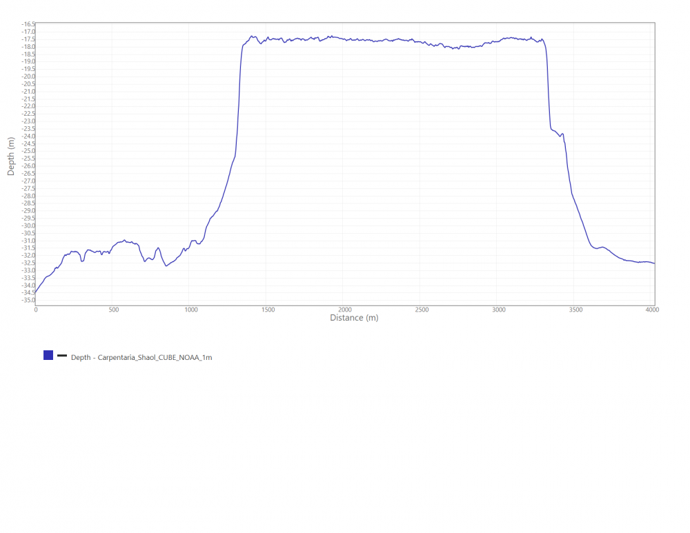
Figure 2: 2D profile across Carpentaria shoal, diagonally across the widest extents from Southwest to Northeast. Depths are below approximate mean sea level (based on AusGeoid09).
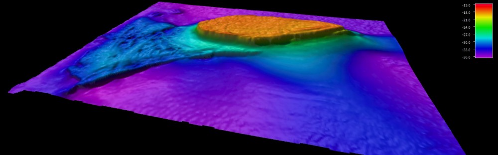
Figure 3: 3D representation of Carpentaria Shoal.
Carpentaria Shoal supports light-dependent benthic communities across the shallow region of the shoal plateau. Multibeam data suggests a distribution of fine-scale rugosity across the top of the plateau. Rugosity is a simple measurement of the surface roughness that is used by coral reef biologists. Areas of high rugosity usually allows corals to attach and grow in shallow regions along the sea floor if the conditions are right. Carpentaria Shoal appears similar to other mesophotic shoals in the northern region of Australia.
Other transects in the region revealed a generally flat homogenous area with a gentle slope deepening from east to west.
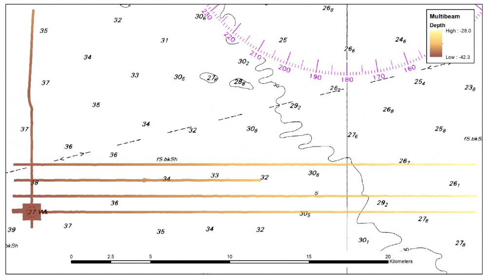
Figure 4: Additional Multibeam Transects south of Carpentaria Shoal.
Additional shorter lines were conducted at 150m line spacing over a reported position of a wreck (Aus. Chart 700) in the south west of the survey area mapping this area of interest in higher detail, however no evidence of a wreck was found. It is important to attempt to locate ship wrecks and validate their location with modern positional equipment when working in remote areas as wreck positions are often reported by the general public without access to accurate underwater positional information.
This survey has produced detailed bathymetry of Carpentaria Shoal and other areas of the West Cape York Marine Park, which will be important data to inform future surveys as well as Marine Park management into the future.
What next?
Other shoals and areas of diversity within West Cape York Marine Park and adjacent to the marine park need to be surveyed to provide a more statistically robust and comparative evaluation of the benthic communities that are present. Planning to determine appropriate survey areas in the northern half of the Gulf of Carpentaria in the future would need to be completed. Further seabed habitat surveys should include multi-beam sonar and a combination of diver visual census, towed video with high resolution digital still imagery, and Baited Remote Underwater Videos (BRUVS) depending on habitat type and depth. This would allow a more thorough understanding of the communities that make up these remote areas.
Related data and publications:
Edgar, G., 2015. Carpentaria Shoal (quadrat survey images). [ONLINE] https://rls.tpac.org.au/pg/912345834/zip/ Reef Life Survey Foundation. [Accessed 24 February 2020]
Green, A. & Giosio, C., 2015. Carpentaria Shoal (quadrat survey images). [ONLINE] https://rls.tpac.org.au/pg/912345835/zip/ Reef Life Survey Foundation. [Accessed 24 February 2020]
Harris, P.T., Heap, A.D., Wassenberg, T. & Passlow, V., 2004b. Submerged coral reefs discovered in the Gulf of Carpentaria, Australia. Marine Geology, 207, 185-191.
Heap, A., Daniell, J., Mazen, D., Harries, P., Sbaffi, L., Fellows, M. & Passlow, V., 2004200. Geomorphology and Sedimentology of the Northern Marine Planning Area of Australia: review and synthesis of relevant literature in support of regional Marine Planning. Record 2004/11. Geoscience Australia, Canberra.
Picard, K., Austine, K., Bergersen, N., Cullen, R., Dando, N., Donohue, D., Edwards, S., Ingleton, T., Jordan, A., Lucieer, V., Parnum, I., Siwabessy, J., Spinoccia, M., Talbot-Smith, R., Waterson, C., 2018. Australian Multibeam Guidelines. Record 2018/19. Geoscience Australia, Canberra.